
Campus Atlas
Description as a Tweet:
Campus Atlas is a searchable, accessible indoor campus map!
Inspiration:
We were inspired to create this project because of our experiences with navigating buildings on campus at UMass. This led to research done by a team member which found that people rated their ability to find specific rooms and offices on campus as less than 50% confidence, on average. We thought of the idea for a campus-wide mapping system to allow us to navigate more easily.
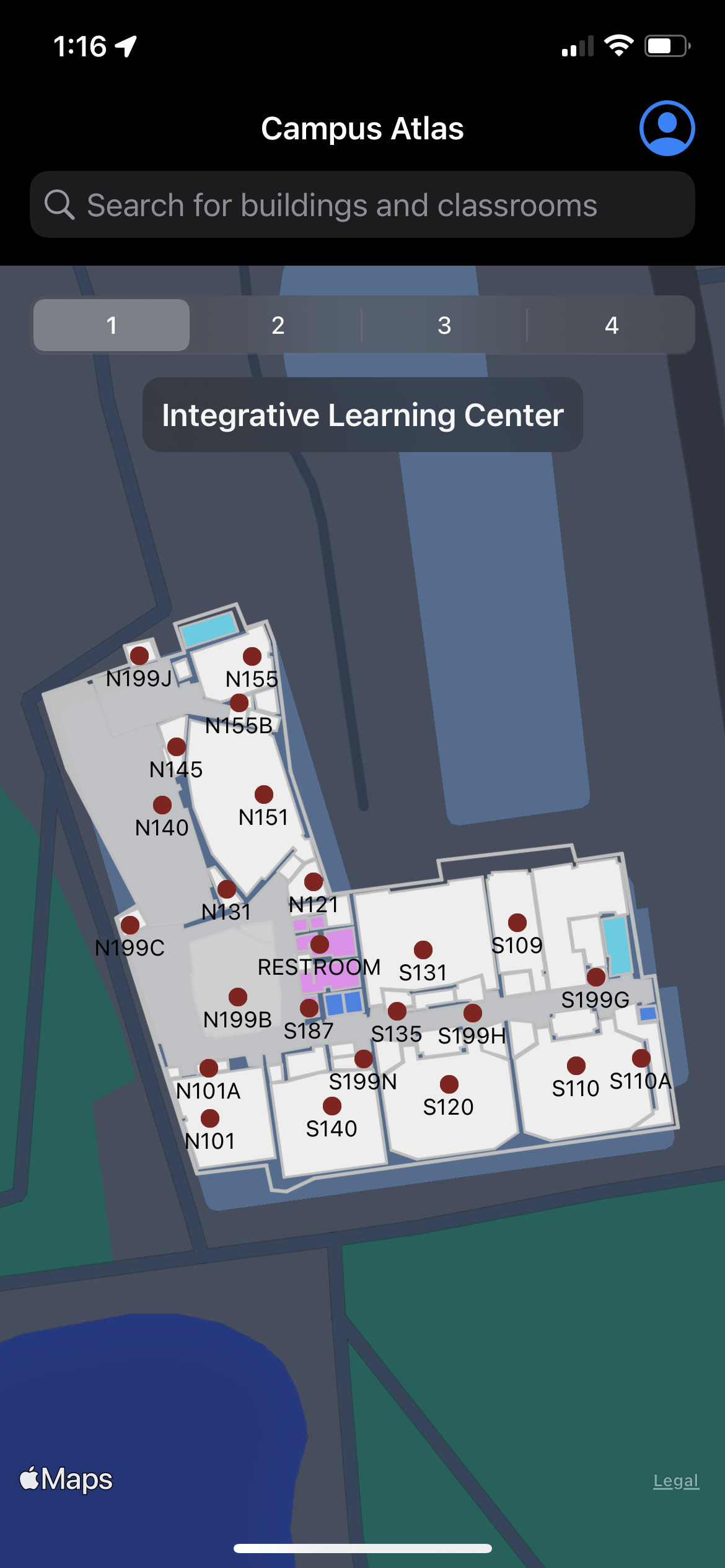
What it does:
Campus Atlas creates a searchable, accessible, and easy to navigate map of indoor spaces on college campuses, as well as creating a data pipeline to create these maps from simple floor plans — even a PDF.
How we built it:
We built a conversion pipeline to go from a simple diagram of a building into a computer-readable IMDF file, served that file via a geocode-aware lambda function, and rendered it on a simple, easy to use app.
Technologies we used:
- SQL
- Swift
- Python
Challenges we ran into:
We don't have direct access to Esri / GIS native building formats, only the PDF. As a result of this, we had to create tooling from scratch to create GeoJSON files from PDFs, and then use those GeoJSON files to construct the IMDF to use in an iOS application. For future improvements, we would work with UMass facilities to get digital versions of the buildings, so we can directly convert those to IMDFs without as many intermediary conversions.
Accomplishments we're proud of:
We were able to use the IMDF specification, which only came out of beta a few weeks ago, and make a fully-fledged app. We took a rudimentary map of a building, and built a whole pipeline around creating useful data out of it. Additionally, we created significant tooling from scratch to construct IMDFs from several data formats. We also created an effective and user-friendly SwiftUI iOS application to display the data we created in the pipeline. And finally, we built a coherent, stable, and scalable backend in a matter of hours.
What we've learned:
We all learned a TON about GIS & Mapping systems, we learned how to build data conversion and analysis pipelines, we learned AWS best practices and implementations, and of course, a few of us picked up a bit of Swift / SwiftUI along the way. Nic also learned a LOT of Python for writing the tools we used! :)
What's next:
We would like to enhance connectivity between our app and the backend -- completely integrating remote IMDF fetching and event loading. We'd also like to consider a cross-platform build, to enable Android users. We are also going to be adding authentication, to lock sensitive data to authorized users. We plan to add wayfinding, both indoors between rooms and outdoors, to help navigation. Finally, we'd work closer with UMass GIS services and UMass Facilities to get the digital versions of the maps, so we can avoid a lot of the hand-drawn rooms and categorization.
Built with:
We used Google Earth to plot out the building, Python to script our data conversions, Swift & SwiftUI for the Data Conversion, AWS Lambda with S3 and RDS for our backend events and IMDF provider, and a whole lot of caffeine and love to keep things together
Prizes we're going for:
- Best Software Hack
- Best Use of AWS
- Best Venture Pitch
- Best Mobile Hack
Prizes Won
Grand Prize
Team Members
Larry Tseng
Rohan Bapat
Conlan Cesar
Ben Burns